Difference between revisions of "A1 (Netherlands)"
Jump to navigation
Jump to search
| Line 110: | Line 110: | ||
| || {{junction}} Knooppunt Azelo {{Anl|35}} || | | | || {{junction}} Knooppunt Azelo {{Anl|35}} || | | ||
|- | |- | ||
| − | | || (29) {{ramp}} [[Borne]]-West<br>{{Good}} Small ramp between two junctions, nevertheless good hard shoulder and enough space for cars to stop. || | | + | | || (29) {{ramp}} [[Borne]]-West<br>{{Good}} Small ramp between two junctions, nevertheless good hard shoulder and enough space for cars to stop. Pay attention though that when coming from direction Amsterdam you can only continue on the A35 towards [[Enschede]] from here, there's no connection to the A1 anymore.|| | |
|- | |- | ||
| || {{junction}} Knooppunt Buren {{Anl|35}} || | | | || {{junction}} Knooppunt Buren {{Anl|35}} || | | ||
Revision as of 22:56, 10 November 2012
The Dutch motorway A1 (Dutch: Rijksweg) begins in the east of Amsterdam at the junction Watergraafsmeer and continues into the German motorway A30 in the east of the country.
The A1 is also known as the E231, between Amsterdam and Amersfoort (east of the junction with the A28/E232) and as the E30 eastward until and into Germany (which it crosses entirely).
Along the way it passes the cities of Amersfoort, Apeldoorn, Deventer, Hengelo, Oldenzaal and Enschede.
<map lat='52.26' lng='6.02' zoom='9' view='0' country='Netherlands' width='900' height='200'/>
Hitching the A 1
Legend:(very good) |
(good) |
(average) |
(bad) |
(senseless)
| (1) |
||
| (2) |
||
| If you want to go eastwards, walk along this ramp until you find a delivery road. Walk along this for some meters until you reach the service station Honswijck! | (3) |
|
| (4) |
If you want to go towards Amsterdam, it's your spot! | |
| (5) |
||
| (6) |
||
| (7) |
||
| (8) |
||
| (9) |
||
| (9A) |
||
| (10) |
||
| (11) |
||
| (12) |
||
| (13) |
||
| Towards East no hard-shoulder, but some green to stand on. Traffic low, should be okay. | (14) |
|
| No hard shoulder in direction east, but it's ok to stand on the side of the road, cars can stop there. Just be extremely careful. | (15) |
|
| (16) |
||
| (17) |
||
| (18) |
||
| (19) |
||
| (20) Huge shoulders, ample place for drivers to stop............. If it only didn't get very little traffic because due to it's location this ramp only serves an industrial estate, a village and one or two housing estates. The majority of cars coming from Apeldoorn will take 21 when driving east or 19 when driving west. |
||
| (21) |
||
| (22) |
||
| (23) |
||
| (24) |
||
| (25) |
||
| (26) |
||
| (27) |
||
| (28) |
||
| (29) |
||
| (30) |
||
| (31) |
||
| (32) |
||
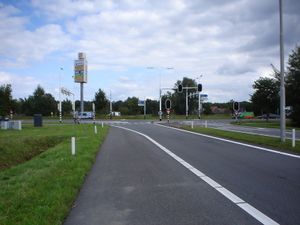
 Ramp in Oldenzaal-Zuid, on the last meters of the A1 |
(33) |
|
| (34) |
||
| border crossing * connection to the German A 30 | ||